Welcome to the Inyo-Mono IRWMP Map Library
The maps below were designed for the user to learn more about the Inyo-Mono IRWM region.
Dynamic Maps: Several Maps are interactive or dynamic and are provided to you through an individual drop-down menu. Others however due to size have limitations in doing so. Instead the links to these interactive maps have been provided below.
The USFS Watershed Condition Framework web application for the Nation is available for use here http://apps.fs.usda.gov/WCFmapviewer/.
To learn more about the USFS Watershed Condition Framework project, please visit http://www.fs.fed.us/publications/watershed/.
To learn more about the Forests to Faucets work conducted by the USFS click on the word “Details” at the top left of the map. You can also visit the USFS Forests to Faucets Webpage.
In February 2014, the Department of Water Resources released its first Water Management Planning Tool. This is a mapping resource, similar to the dynamic maps provided on this website, where users can view various types of information about any part of California. Click here to go to the WMPT website.
Click here to see an interactive map for California ELAP Certified Laboratories
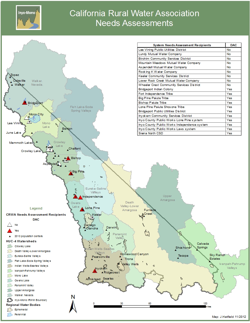
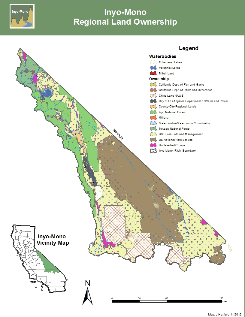
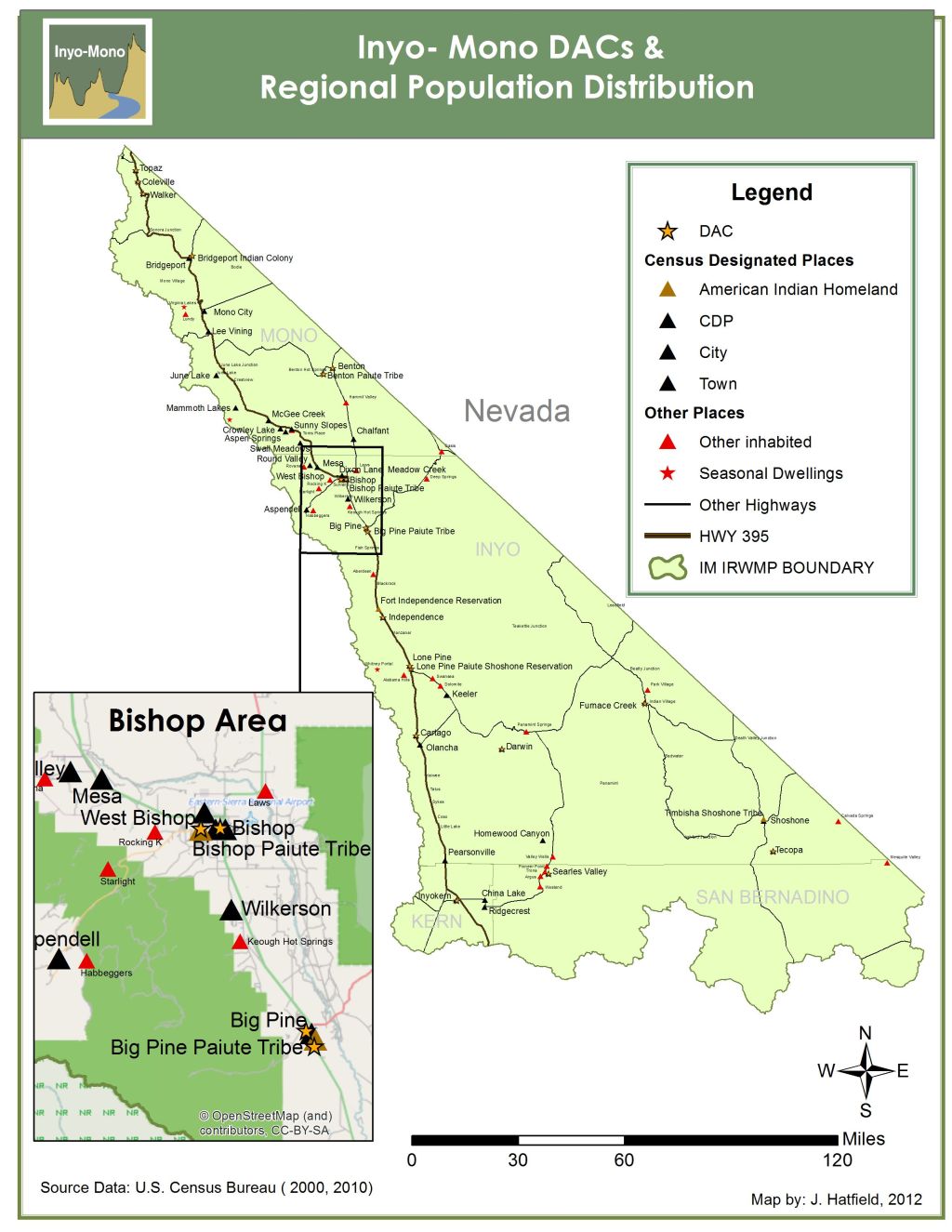
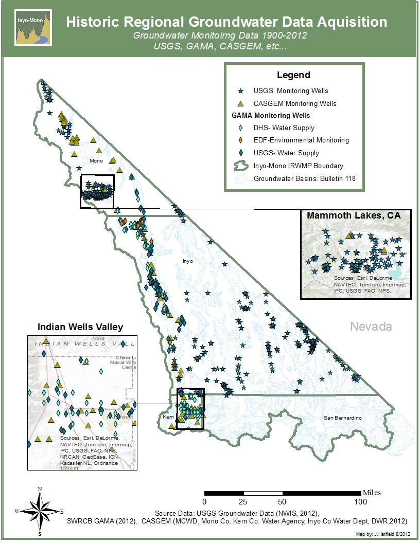
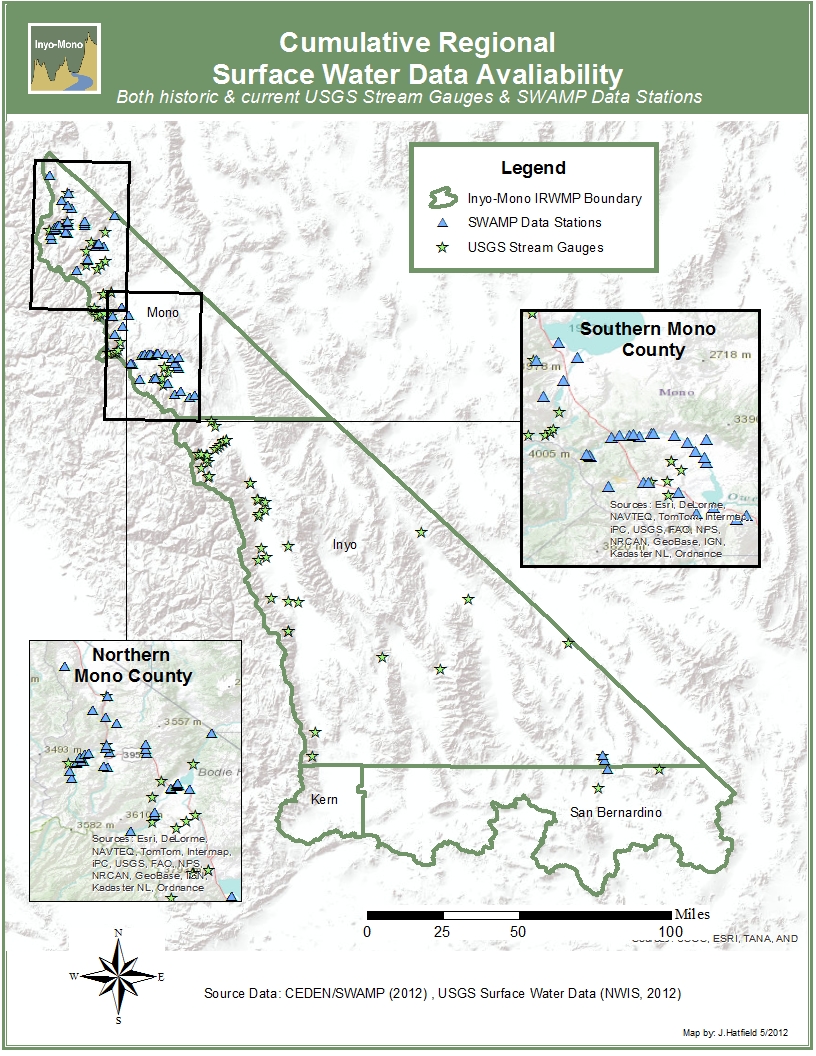
Click on any of the images below to view larger map. Right click to save to your computer.
2011
2012

2012

20
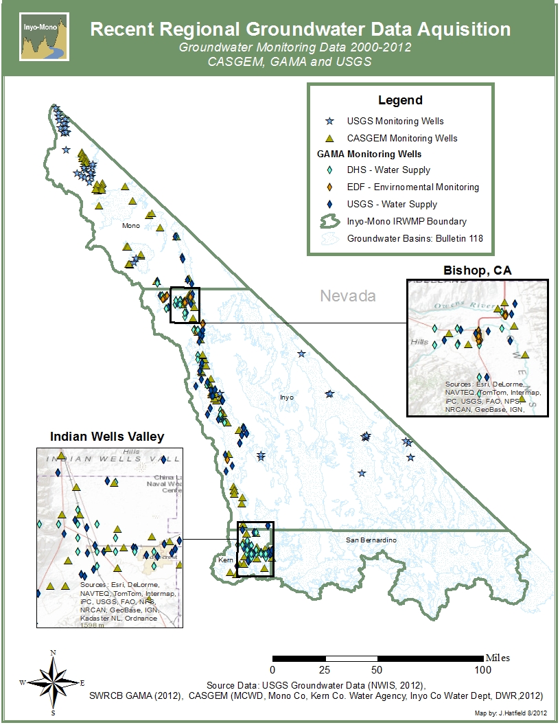
2000-2012
2012